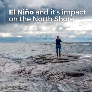
What Is El Niño and What Could It Mean for Winter on Minnesota’s North Shore?
October 2026
If you have been hearing more about El Niño lately, you may be wondering what it actually means for winter on Minnesota’s North Shore. Does it mean less snow? Warmer temperatures? Less ice on Lake Superior? The answer is a little more complicated than a simple warm or cold forecast, especially in a place where Lake Superior has such a strong influence on local conditions.
El Niño is part of a naturally occurring climate pattern called the El Niño-Southern Oscillation, or ENSO. During an El Niño event, surface waters in the central and eastern tropical Pacific Ocean become warmer than usual. The Pacific may be a long way from Lake Superior, but those warmer waters can affect atmospheric circulation and shift the jet stream across North America. Since the jet stream helps guide storms and move warm and cold air around the continent, those changes can eventually influence the kind of winter we experience here in Minnesota.
According to the U.S. Geological Survey’s research on regional El Niño impacts in the Midwest, El Niño winters are commonly warmer than usual across the Midwest, although that is not the case every year. The connection has been particularly noticeable in Minnesota and Wisconsin. During recent strong El Niño events, winter temperatures across parts of the Midwest have ranged from about 3 degrees to more than 8 degrees warmer than the 20th-century average. El Niño winters can also bring fewer major cold spells.
Of course, warmer than average in northern Minnesota is still winter. An El Niño pattern does not mean you can leave the boots, gloves and winter coat at home. Cold snaps and snowstorms can still roll through, and anyone who has spent much time along Lake Superior knows how quickly conditions can change.
What About Snow on the North Shore?
This is where predicting an El Niño winter becomes a little trickier. The USGS notes that the Midwest generally receives less snow during El Niño winters, but precipitation is much more difficult to predict than temperature. A warmer overall winter does not mean a snow-free North Shore, and individual storms can still bring plenty of fresh snow.
Lake Superior adds another variable. When cold air travels across comparatively warmer, open lake water, it can pick up moisture and help produce lake-effect snow. Wind direction, temperatures and other atmospheric conditions all play a role, which is why snowfall can vary so much from one place to another along the shore.
For anyone planning a winter trip around skiing, snowshoeing or hiking, current conditions will ultimately tell you much more than the El Niño label alone. Check snow and trail reports as your trip gets closer and be prepared for conditions to change during your stay. That flexibility is part of winter travel on the North Shore.
El Niño and Lake Superior
El Niño can also affect the amount of ice that forms across Lake Superior. Warmer winters would generally be expected to produce less ice, and the USGS found that Lake Superior's maximum ice coverage was below average during three of the four recent very strong El Niño events it studied. That pattern is not absolute, though. During the 1991-1992 El Niño winter, Lake Superior actually experienced more ice than average, and researchers have found that the relationship between El Niño and Great Lakes ice has become less consistent since the late 1990s.
Less ice can leave more open water exposed to winter winds, which may also mean more wave action along the shoreline. For those of us who love watching Lake Superior change from one day to the next, that can make winter especially interesting. A calm lake can turn wild and dramatic as the wind picks up, then settle back down again.
At Cliff Dweller, you do not have to go far to see those changes. Every room faces Lake Superior, so watching the lake is simply part of staying here. On a windy morning you can enjoy the view from your room, and when conditions are calmer, you can bundle up and head outside. The Gitchi-Gami State Trail is accessible right from the property, making it easy to fit in a winter walk without having to drive somewhere first.
Planning a North Shore Trip During an El Niño Winter
The best way to approach an El Niño winter is to think of it as a general seasonal tendency rather than a promise about the weather you will find during your trip. You could arrive during a mild stretch with open water on Lake Superior, then wake up to fresh snow the next morning. Another visit could bring cold temperatures, snowy trails and ice beginning to form along the shoreline.
Packing layers is always a good idea. Bring a warm coat, hat, gloves and waterproof footwear with good traction. Temperatures near freezing can create a mix of snow, melting and refreezing, so sturdy boots can be just as useful as your warmest jacket. If skiing or snowshoeing is part of your plans, check local trail conditions shortly before heading out.
There is also plenty to enjoy when the weather does not cooperate with a perfectly planned winter itinerary. Take a scenic drive along Highway 61, visit a nearby state park, enjoy a quiet walk along the shore or simply slow down and watch Lake Superior from your room. Some of the most memorable North Shore days are the ones without much of a schedule.
Winter on Lake Superior Is Still Winter
The biggest thing to remember is that El Niño influences the odds of certain weather patterns. It does not determine the forecast for every day of the season. Snowstorms, cold snaps, mild afternoons and dramatic changes on Lake Superior are all still possible.
That unpredictability is also part of what makes winter on the North Shore so beautiful. The lake rarely looks exactly the same two days in a row, and winter has a quieter pace that can be hard to find during the busier summer and fall seasons.
El Niño may shape parts of the season, but Lake Superior will still have plenty of surprises of its own. Pack for changing conditions, leave a little flexibility in your plans and enjoy winter as it comes. At Cliff Dweller, you will have a front-row view of it all.